 |
 |
||||||||||||||||||||||
|
| |||||||||||||||||||||||
|
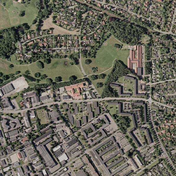
An orthophoto is a photograph that is geometrically corrected or orthorectified. It can be considered as an image representation of a map where the scale is uniform. Orthophoto can be used to measure true distances, unlike an uncorrected aerial photograph, that represent the earth's surface, as it has been adjusted for topographic relief, lens distortion, camera tilt etc. Orthophoto is often a mosaic of a series of orthophotos that covers a small or large area of land where all individual orthophotos are feathered / blended together following some seam lines. These seam lines can be generated either automatically or manually. Regardless of how they are created, the seam lines defines where in the overlapping zone between two images the actual division will take place. As a result, automatically generated seam lines need to be checked whether they are crossing a building, structure etc. to ensure a seamless mosaic. Decode has large experience on the correction of automatically generated seam lines or producing manual seam line for Ortho-mosaic. Decode is extending its digital orthophoto production capabilities to ensure the requirement of high-end mapping requirements with emphasis on geometric quality, color balance, edge matching etc. Our highly skilled operators, trained in Denmark, are able to handle very large orthophoto projects with emphasis on time and throughput. |
|
|||||||||||||||||||||
|
|
|||||||||||||||||||||||